

Ho Chi Minh City is implementing a project that uses unmanned aerial vehicles (UAVs) to survey existing conditions, create digital maps and collect data to support administrative management across the city’s 168 wards, communes and special zones.
An Effective Management Tool
Tru Van Tho Commune is the first locality in Ho Chi Minh City and nationwide to coordinate with the Ho Chi Minh City Department of Science and Technology in piloting the use of UAVs to document existing conditions, collect aerial imagery and develop spatial data layers for local government management.
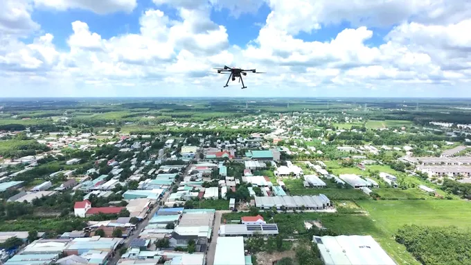
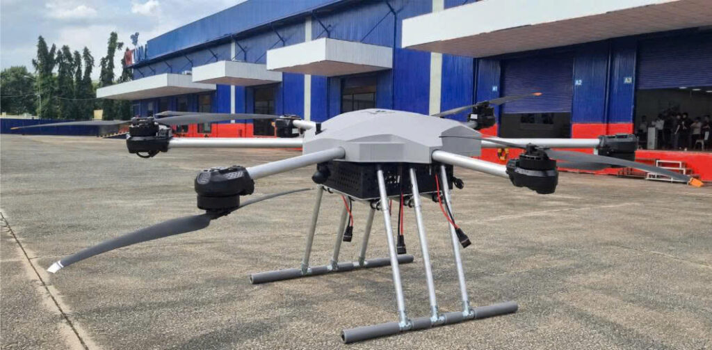
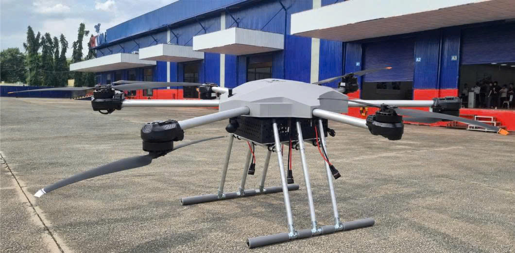
UAV conducting an aerial survey over Tru Van Tho Commune. Photo: QUANG HUY
According to Luu Van Long, Secretary of the Tru Van Tho Commune Party Committee and Chairman of the Commune People’s Council, Tru Van Tho is an outlying area of Ho Chi Minh City bordering Dong Nai. It is home to the more-than-700-hectare Cay Truong Industrial Park as well as the expanded Bau Bang Industrial Park. By 2030, the commune aims to significantly increase the contribution of industry, trade and services to its local economy while accelerating the adoption of high-tech agriculture to improve residents’ incomes. However, the commune’s extensive geographical area, encompassing residential communities, agricultural land, transport infrastructure and a dense network of canals, presents considerable challenges for conventional management methods. After being selected for the pilot programme, the local authorities coordinated the first UAV survey flights in June. The data collected by the UAVs provides a foundation for building a visual, integrated database that can be updated regularly, thereby supporting more effective local government management.
Following Tru Van Tho, the communes of Bau Bang, Tan Vinh Loc, Ben Cat, Can Gio and Hung Long have also begun implementing the initiative. Huynh Van Pham Hong, Chairman of the Hung Long Commune People’s Committee, said the commune covers nearly 36 square kilometres and is undergoing rapid urbanisation. Until now, the management of land, construction compliance and urban planning has relied primarily on field inspections. This approach makes it difficult to obtain a comprehensive overview or promptly detect unlicensed construction, construction inconsistent with approved permits, land encroachment or occupation of canal protection corridors. Meanwhile, the development of digital government requires local authorities to establish an integrated database that can be updated regularly.
According to Huynh Van Pham Hong, the commune has approved in principle the procurement of a technology service integrating UAVs with a geographic information system (GIS) to create a Digital Twin. The system will establish a spatial database, monitor changes in existing conditions in real time, support the detection of land, construction and environmental violations, and improve the effectiveness of local administration and decision-making.
Moving Towards Citywide Deployment
Pham Huynh Quang Hieu, Deputy Director of the Ho Chi Minh City Department of Science and Technology, said the project is being jointly implemented by the department, CT UAV and GASCOLAE, both members of CT Group. The initiative forms part of Plan No. 200/KH-UBND, issued by the Ho Chi Minh City People’s Committee on May 18, 2026, for the development of the Low-Altitude Economy in the city through 2030. Under the project, CT UAV is responsible for conducting UAV-based surveys and producing digital maps, while GASCOLAE develops services for the Low-Altitude Economy.
According to Hieu, compared with conventional methods, UAVs can rapidly survey large areas, access locations that are difficult to observe directly and generate visual, integrated data that can be updated in real time. This data enables local authorities to reduce their reliance on fragmented reports while providing additional tools for analysis, forecasting and evidence-based decision-making. The Ho Chi Minh City Department of Science and Technology is continuing to coordinate with municipal departments, agencies and local authorities to study an end-to-end service model for applying UAV technology to urban management, construction compliance, forest management, high-tech agriculture, logistics and delivery, and emergency medical services. The ultimate objective is to deploy the model across all 168 wards, communes and special zones in Ho Chi Minh City.
The project deploys UAVs developed by CT Group, with a maximum flight time of 60 minutes, a control range of up to 15 kilometres and a 4K HD camera for aerial data collection.
According to the company, the UAVs have an 87.5% localisation rate and were designed, manufactured and integrated by Vietnamese engineers. Commenting further on the pilot programme’s results, Nguyen Van Vinh, Head of Business Development at GASCOLAE, said the integration of UAVs and GIS technology in Tru Van Tho Commune had produced highly accurate and intuitive 2D and 3D digital maps. These maps integrate multidimensional data and provide a comprehensive representation of existing conditions across the commune. The system provides an important foundation for urban, land and infrastructure management, as well as for monitoring changes in construction activity and land use. It can also support the estimation of carbon-credit potential, contributing to the pursuit of green development objectives.
During the pilot phase, participating local authorities are not required to bear any costs. GASCOLAE covers all expenses associated with site surveys, UAV operations, data processing, the development of 2D and 3D maps, and technical support. Following the pilot phase, the company will continue supporting local authorities in operating the system, updating the data and refining the solution to maximise the effectiveness of the digital platform in state administration.
________________________
Follow CT Group on Facebook for the latest updates and news!